Project outline
Melbourne Water engaged DCE to assess options for the Mittagong Creek Development Services Strategy (DSS) to support development within the Wallan Structure Plan and ensure protection from flooding.
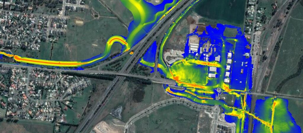
A two-dimensional hydrodynamic (TUFLOW) model was developed to simulate the complex hydraulics at the confluence of Wallan and Mittagong Creeks. The existing RORB model was updated to Australian Rainfall & Runoff 2016 standards in collaboration with Melbourne Water, ensuring all hydrological inputs were verified by stakeholders.
Four concept designs were modelled, considering site constraints such as the Yarra Valley Water sewer pump station and flood protection to the 1% AEP event. Rigorous sensitivity testing confirmed the model’s accuracy, with downstream flood mapping used to inform future urban growth.
The preferred DSS solution was optimised to minimise infrastructure requirements while maintaining effective flood protection for Wallan’s continued development.